Foreca Nowcasting
Foreca Nowcasting is a state-of-the-art method in weather forecasting for drastically improving the accuracy of the following hours' forecast. As a by-product, it also greatly improves current condition forecasts (synthetic observations). Foreca Nowcasting is a unique method developed by Foreca.
Why Use Foreca Nowcasting

Synthetic Observations On-Demand
Nowcasting enables forecasting of current weather conditions anywhere with the highest level of accuracy

Most Accurate Forecasts
Nowcasting drastically improves the accuracy of the next 0-4 hours' hyper-local weather forecasts.

Track Local Rains and Clouds
Nowcasting is especially beneficial in forecasting local rain that is otherwise extremely difficult to forecast precisely at a certain point and time.
Introduction to Foreca Nowcasting
There are always errors in any prediction of the future, and weather forecasts are not an exception. The errors increase as the forecasts get longer, so the shortest forecasts are usually the most accurate, even if only traditional forecast methods are used. Nowcasting adds new methods to the mix that are applicable only for the immediate future, making the shortest forecasts even more accurate.
Since weather phenomena move around the world, weather forecasts need to take the entire Earth's atmosphere into consideration. To provide a concrete example, the weather in London next weekend can be affected by what happens to the weather in Mexico today. To cover the global scale, Foreca uses global weather models such as the ECMWF. Since global forecast models are calculated every six or twelve hours, and the calculations take several hours, they are already a little out-of-date at the time of publication. There are also small-scale weather phenomena which the coarse global model grid cannot represent.
The ECMWF model is universally recognized to be the most accurate global forecast model, and it often beats local area weather models in flat terrain. The ECMWF data is of fantastic quality and is usable as such. But to further enhance the forecasts, Foreca uses multiple local weather models and post-processing techniques to make its own Foreca Weather Model even more accurate. On top of that, Foreca Nowcasting can add further improvement for the crucial first hours.
How It Works?
Foreca Nowcasting is calculated on-demand for the point-of-interest by taking all the latest local and global factors into account. The following graph illustrates the remarkable impact that Foreca Nowcasting has on reducing the forecast error during the first hours.
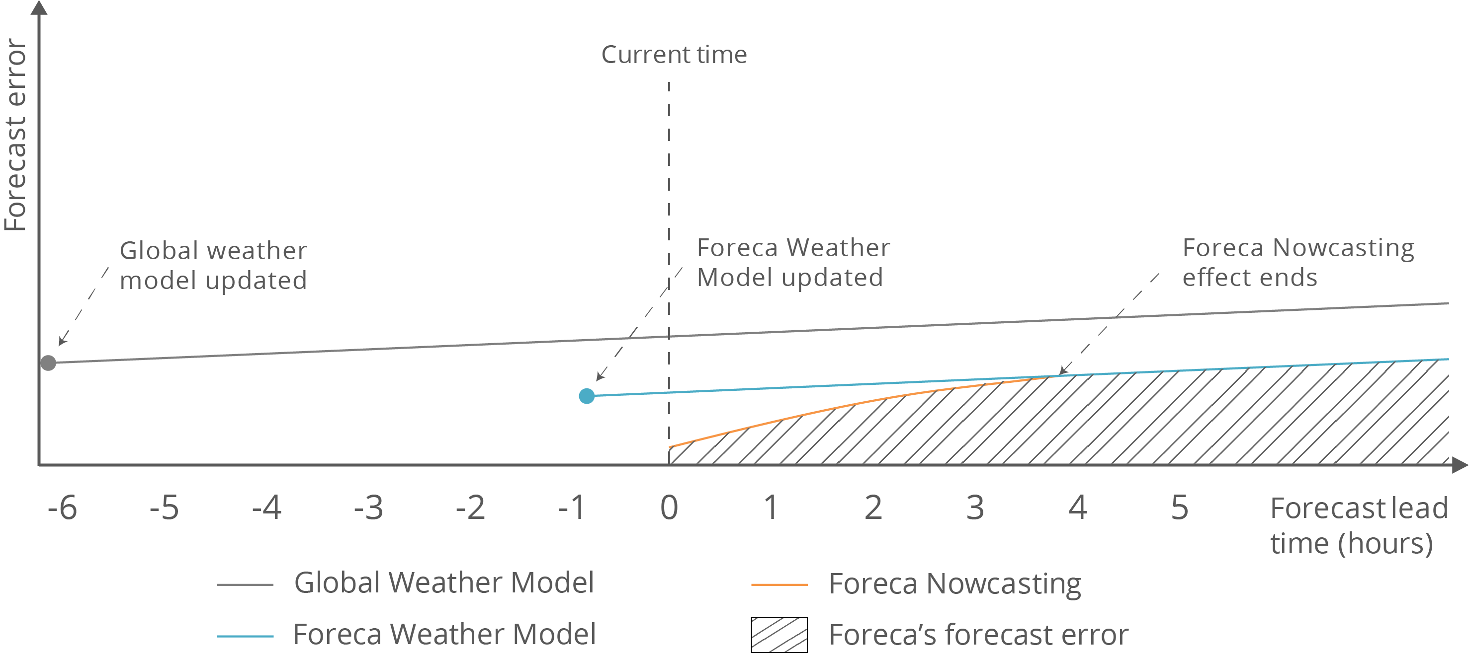
Foreca Nowcasting can be used to fine-tune the Foreca Weather Model with weather measurements that have been taken after the model was initialised. The Foreca Nowcasting System fuses radar, satellite and weather station measurements and runs a new high-resolution Nowcast several times per hour, improving both the resolution and accuracy of the first hours' forecast.
The accuracy of Nowcasting depends on the amount and quality of real-time data sources available in the area. In the following, we'll take a look at this as a series of simplified pictures to open up what Nowcasting is all about and how the different real-time data sources are used to fine-tune the forecasting accuracy.
An Example of Providing Synthetic Current Conditions
It is possible to be aware of the current conditions with certainty only in points that have measurement equipment, i.e. weather stations. Everywhere else, the computer relies on sophisticated physical analysis to get as probable a value as possible for every single point of air, sea and ground.
As there is no weather station at the random coordinate (the cross-hairs in the following pictures) in this example, a synthetic observation has to be calculated to provide the current weather conditions. To make the synthetic observation as accurate as possible, we demonstrate the Foreca Nowcasting method in the following.
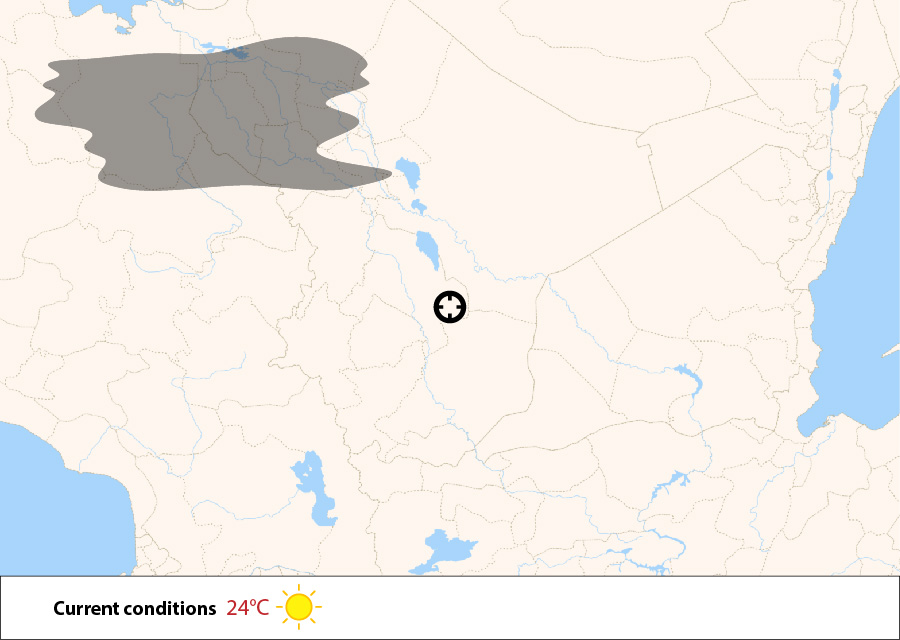
Picture 1: Foreca Weather Model (FWM) information only
In picture 1, the Foreca Weather Model (FWM) has forecasted 24°C and sunny for the given time in this coordinate. As the global forecast has been made a couple of hours before this current situation, we would need to rely on already a little bit outdated information. A cloud is forecasted to be located North West and seems to not affect the weather at our chosen location.
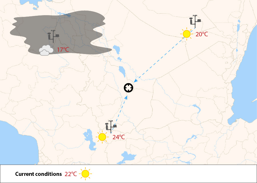
Picture 2: FWM + nearest weather stations
In picture 2, we demonstrate that we have gotten the latest measurements from the nearest weather stations and used them to fine-tune the forecast. The conditions will be corrected by two degrees down to 22°C, based on the interpolated data from the nearest weather stations. This is not a simple linear interpolation but takes into account the land-water distribution and elevation differences in the area in a sophisticated way. The cloud in the North West is confirmed at the point of the weather station in that area.
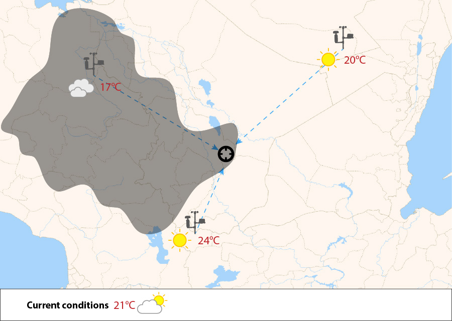
Picture 3: FWM + nearest weather stations + satellite
In picture 3, we have included the latest satellite data and found out that the cloud appears to be larger than forecasted. The current conditions, or synthetic observation, at the chosen location is updated to show 'partly cloudy', and the temperature is corrected due to some clouds in the area.
Picture 4: FWM + nearest weather stations + satellite + radar
In picture 4, we have included the latest weather radar data and found some unpredicted rain (in green). It does not affect the synthetic observation, though.
Many other forecasters rely on point-based data, when forecasts are made for the nearest weather station location and interpolated using various techniques. This is always inferior to a real forecast made for the exact location of interest.

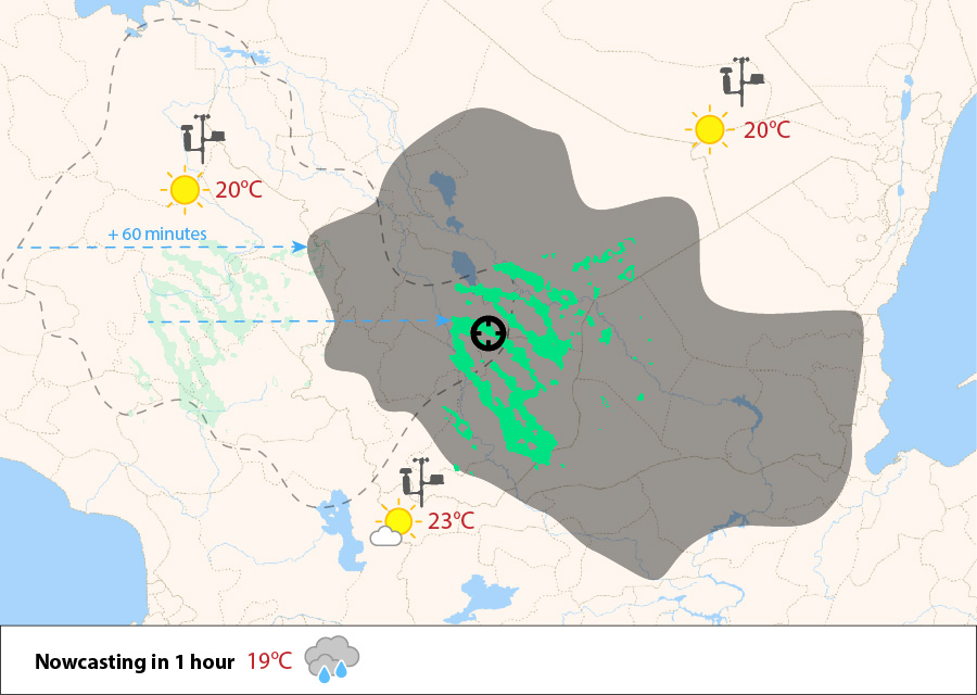
Hyper-Local Forecasts for the Following Hours
Accurate information about current conditions is crucial to be able to make hyper-local forecasts. With some additional work, the above-demonstrated principles can also be used to improve the following hours' data to provide truly hyper-local weather forecasts for the following hours.
Summary
Foreca Nowcasting is the most accurate forecasting method for the following hours due to the following reasons:
- It is always based on the most recent weather measurements in the area, including remote-sensing by satellite and radar.
- It creates a multi-dimensional model by fusing measurements from all the available sources like the closest weather stations, weather radars, satellites and even mobile measurements.
- It fuses all the information with the large scale (global) weather forecasts made by supercomputers.
- It tracks the actual cloud movements and rain areas to calculate their effects on temperature, cloudiness and rain intensity.
Foreca is constantly evaluating new data sources and inventing new post-processing techniques to provide the best possible forecast accuracy worldwide.